Ecohydrology & Ecosystem dynamics in the Critical Zone
~ Western Montane Forests ~
~ Western Montane Forests ~

Background:
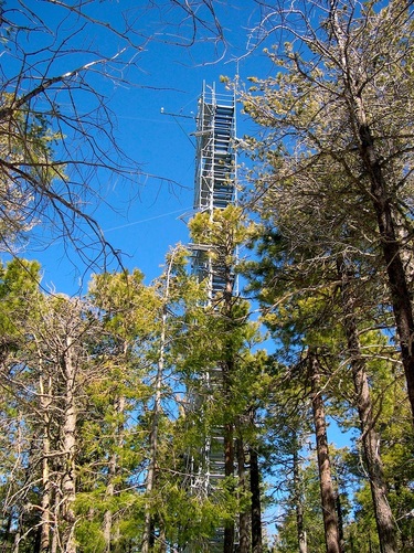
Western North American Forests represent a potential, yet uncertain, sink for atmospheric carbon. The Mt. Bigelow eddy covariance site is located on a sky island, (a type of continental terrain consisting of a sequence of valleys and mountains isolated by the surrounding desert floor), in the Santa Catalina Mountains of the Coronado National Forest, NE of Tucson, Arizona.
This sub-alpine mixed forest ecosystem of predominantly of Ponderosa Pine (Pinus ponderosa), Mexican White Pine (Pinus strobiformis Engelmann), Douglas fir (Pseudotsuga menziesii), and Chihuahua pine (Pinus leiophylla), with occasional Southwestern white pine (Pinus strobiformis Engelmann) and White fir (Abies concolor). Much of the woody regeneration in the sub-canopy is Douglas fir. These species exist only at the tops of mountains in this region because it is only here that, as a long-term average, precipitation input exceeds evapotranspiration to the extent that forest vegetation can survive.

Critical Zone science is a biogeographical science!
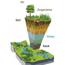
The critical zone is the "Earth's outer skin", where living organisms, air, soil, water, and rock interact and shape the Earth's surface. In Physical Geography, we tend to refer to these are the four "Earth Realms" ~ The Biosphere, Atmosphere, Hydrosphere, and Lithosphere...
Regardless of the lingo, we're all looking into the complex interactions and feedbacks among these dynamic layers of the Earth's surface, and we are working across disciplines to do this science!
We have a hard time understanding the processes underlying the patterns we see within our own research unless we can put it into the greater context of a site or region.
The Biosphere isn't operating in isolation ~ neither can our science...
The Barron-Gafford Research Group's role within our NSF-funded CZO site (link!) is to:
* Maintain the Mt. Bigelow eddy covariance site
* Maintain the sap flux measurements of water loss from trees
* Measure patterns of soil CO2 and evaporative water loss
* Monitor soil CO2 concentrations using vertical profiles of Vaisala soil CO2 probes
* Measure leaf-level carbon and water exchange to understand the seasonality of rates of photosynthesis and the sensitivities of photosynthesis to drought and temperature stress
* Consider the role of complex topography (the influence of slope and aspect) on all of these factors.
* Support research by graduate students and visiting undergraduates participating in our NSF-funded Research Experiences for Undergraduates program.
(Image credit: CZO; http://criticalzone.org/national/research/the-critical-zone-1national/)
There are opportunities for graduate and undergraduate research in all aspects of this work - contact us via the "Join Us" tab above.
